
Rostyslav Khotyn / Radio Svoboda
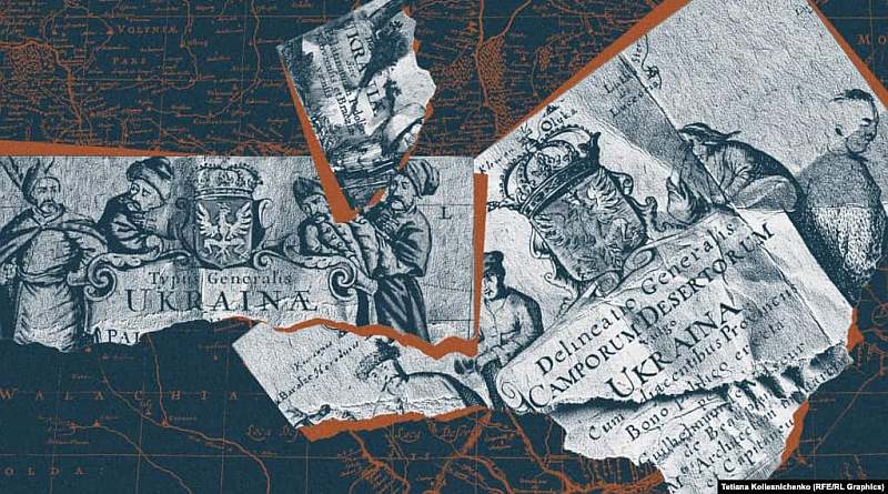
European cartography firmly established the name “Ukraine” on 17th and 18th-century maps. It also effectively identified Ukraine as the country of the Cossacks. The Cossacks themselves actively appeared on ancient maps—in the cartouches—meaning decorated titles.
- Were ordinary Cossacks depicted on the maps, or just the senior officers?
- Is it true that two hetmans—Bohdan Khmelnytsky and Ivan Mazepa—were depicted on the maps?
- How did Cossack women appear on the maps, and what does this indicate?
- Did map colorists from several centuries ago portray the Cossacks very vibrantly—and did the Cossacks truly dress with such taste?
The Cossacks were “lucky” that the renowned French military engineer and cartographer Guillaume Le Vasseur de Beauplan (1600–1673) spent 17 years in Ukraine in the service of the Polish king—from 1630 to 1647. He wrote his “Description of Ukraine,” first publishing the book in French in 1650, and then—as “Description of Ukraine”—in 1660, which was later republished in several languages.
But Beauplan’s greatest contribution to popularizing Ukraine was also in his maps. We will examine just one aspect of European cartography of Ukraine in the 17th and 18th centuries, namely, how Ukrainian Cossacks were depicted on them.
Cossacks were depicted in the cartouches—the engraved titles on maps.
The first map with the name Ukraine featuring Cossacks in the cartouche was a map by Guillaume Le Vasseur de Beauplan. Its Latin title: Delineatio Generalis Camporum Desertorum vulgo Ukraina. Cum adjacentibus Provinciis—”General Plan of the Wild Fields, commonly known as Ukraine, with adjacent provinces,” engraved in Gdańsk by the well-known Dutch engraver Willem Hondius in 1648.
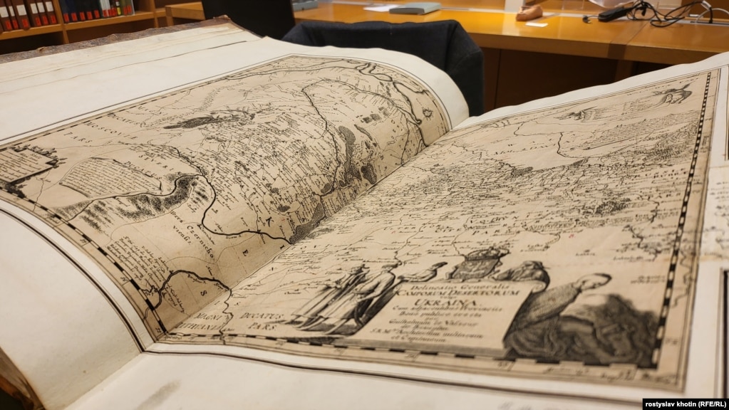
Interestingly, it features Cossacks. Although some Polish experts claim they are Poles, Ukrainian and authoritative international experts insist they are indeed Ukrainian Cossacks.
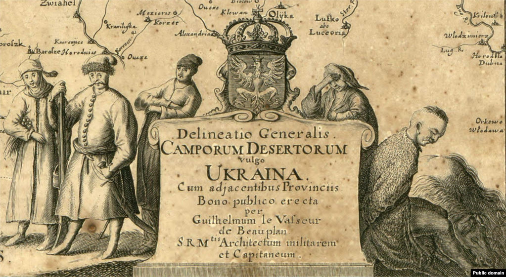
“Why would Beauplan, when he clearly calls the map the map of Ukraine, depict Poles on it? He could have depicted Crimean Tatars or Ottomans there… Definitely, on this map he is showing Ukrainian Cossacks,” says in an interview with Radio Liberty expert cartographer Andriy Baysar, associate professor of the Department of Geography of Ukraine at Lviv National University.
“For Beauplan, the driving force of Ukraine was the Ukrainian Cossack. He knew the townspeople and peasants, but he understood that the driving force of Ukrainians were the Cossacks, truly warlike but at the same time kind, freedom-loving people. It’s pleasing that a person of such a European level as Beauplan identified our nation with the elite, with knights, who were the Cossacks,” adds the specialist in ancient maps.
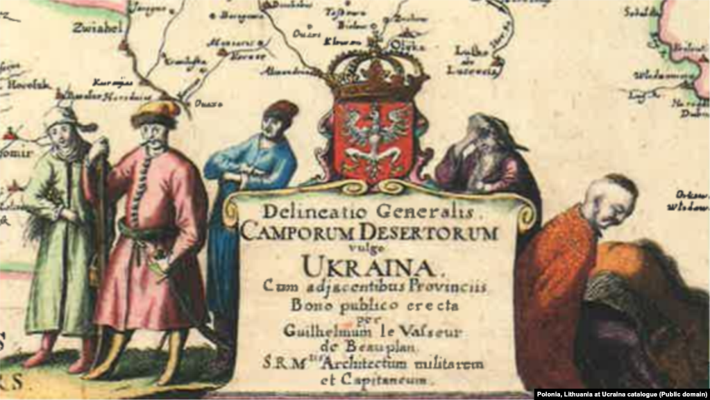
This cartouche is also interesting because, according to Radio Liberty’s interlocutors, this map from 1648 and the later French publication from 1660 depict ordinary Cossacks, not officers or colonels. That is, it embodies Cossack democracy.
And one more important thing: the map shows five figures, but two of them are Cossack women. Very few European maps of the 17th century depicted women.
“This is generally unique. Unique not only for Eastern Europe but even for Western Europe. Women there did not have such rights until the end of the 18th century, until the French Revolution, as they did in Ukraine. If you read the Constitution of Pylyp Orlyk in 1710, it clearly states that Cossack women and Cossack widows had the same rights as Cossacks. They inherited the property of the Cossacks and were recorded in the registers of the time alongside the Cossacks. So, this is a unique phenomenon, that Ukraine was ahead of most European countries regarding the equality of men and women. That is, Cossacks respected women,” says Radio Liberty historian and specialist in the Cossack era, author of many monographs about the Cossacks, Taras Chukhlib.
Khmelnytsky on the map?
The next map featuring Cossacks is the unique, huge (on eight sheets!) Special Map of Ukraine, also by Beauplan and Hondius, published in Gdansk in 1650. It is extremely rare—already becoming so in the 18th century—and has survived in 12-13 copies worldwide, with none in Ukraine.
But here’s what’s interesting: some experts suggest that on the map, in the group of four prominent Cossacks on the right side wearing a feathered hat, might be depicted Hetman Bohdan Khmelnytsky. Hondius knew what the founder of the Cossack state looked like, as he created an engraving of Khmelnytsky in 1651.
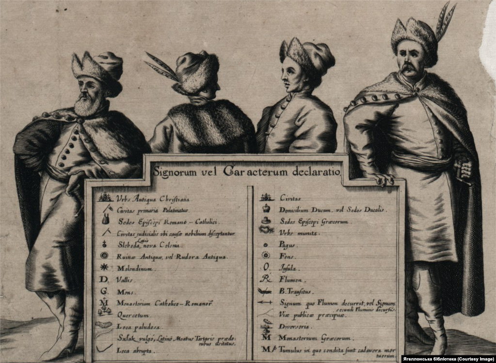
“You know, I also asked myself this question. One of the theories is that Beauplan indeed might have depicted Khmelnytsky. Perhaps not Beauplan himself, but this was done by Hondius or maybe they did it together. But this theory definitely has a right to exist,” says Andriy Baytsar.
Another map with a cartouche featuring Cossacks is the General Map of Ukraine, also by Beauplan, but oriented not to the south, but standardly to the north. It has several states (versions), first published in 1657 and reissued in 1680, with several other later editions. These were mainly by different cartographers, mostly in the Netherlands.
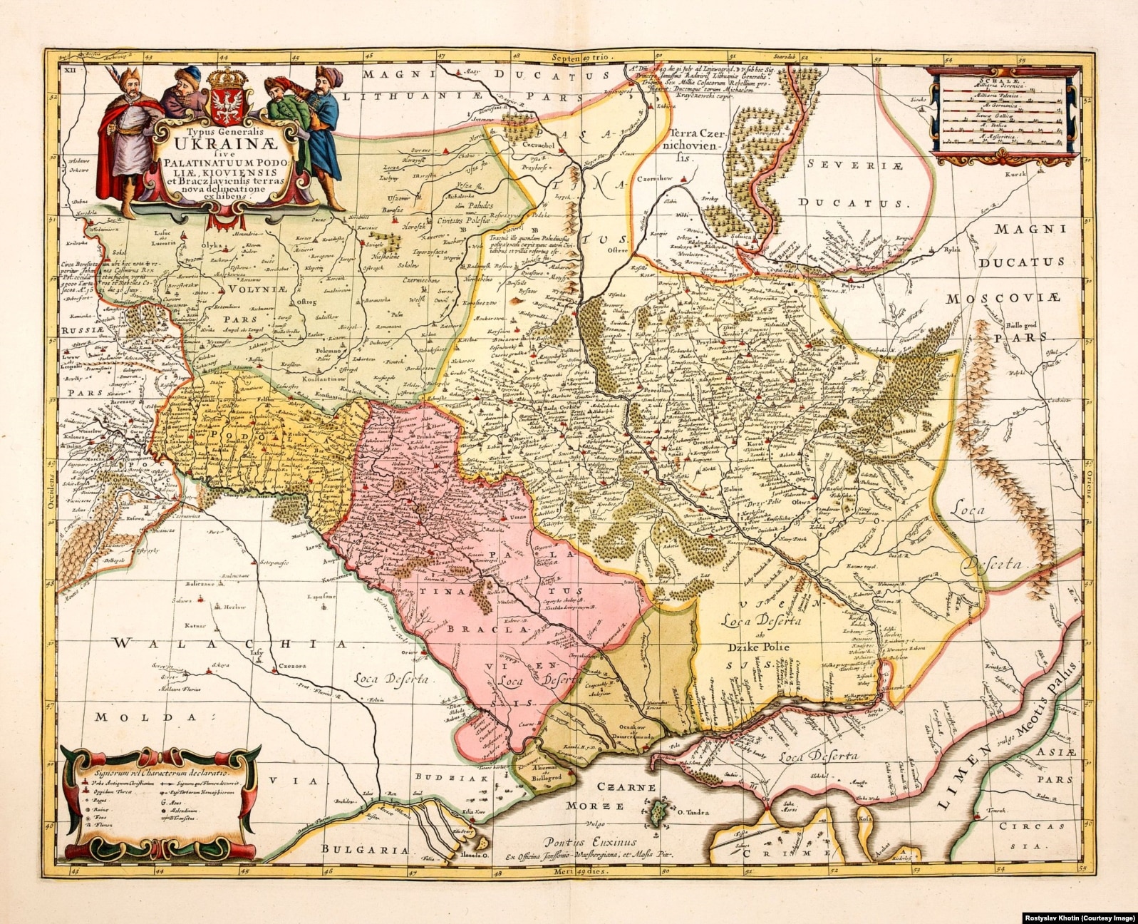
So, on the left side of the map’s cartouche, Khmelnytsky might also be depicted, as speculated. The first edition of the map was published in Amsterdam by Jan Jansson in 1657 – the same year the hetman died.
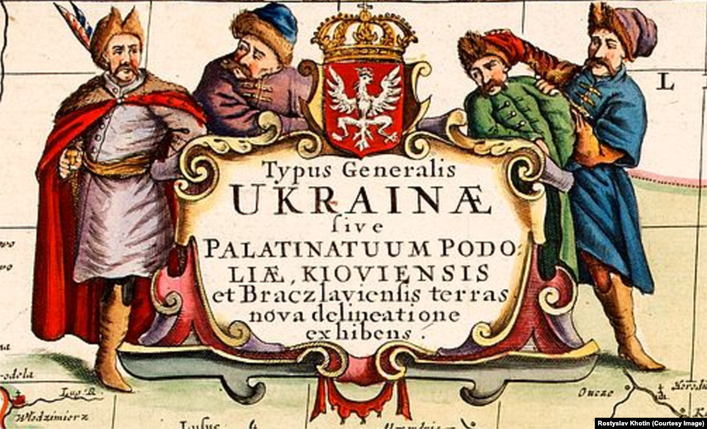
“On this map – there, no longer ordinary Cossacks, but indeed the senior officers are depicted. It’s evident from the colors, too. These colors, by the way, are very plausible. Initially, the maps were printed in black and white and then hand-colored,” explains Baytsar.
Maps of Parts of Ukraine
Cossacks also appear on four maps of Ukraine, which were published in 1660 in Amsterdam by the “king” of European mapping, a key figure of the so-called “Golden Age” of Dutch cartography Joan Blaeu.
These maps – of Kyiv, Braclav Voivodeships, Podolia, and Pokuttia – were created based on Beauplan’s Special Map of Ukraine, which we mentioned earlier.
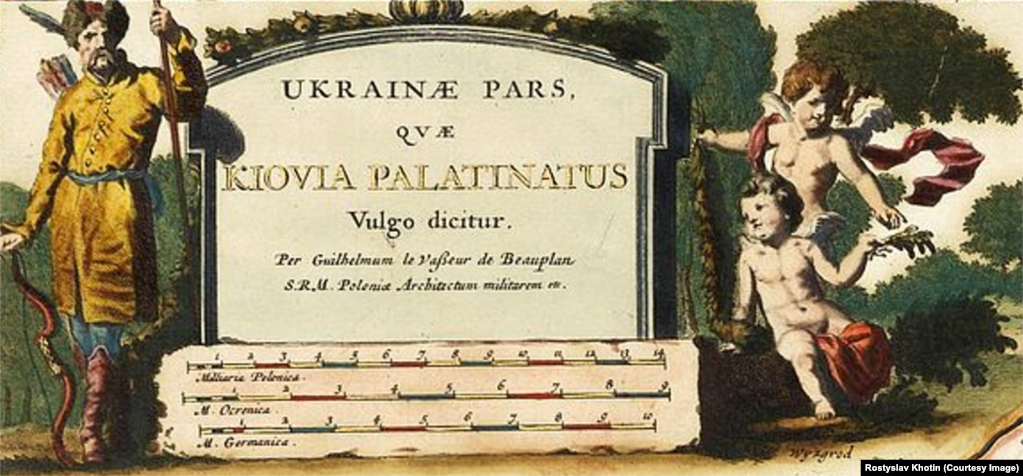
Maps of the four parts of Ukraine were also published twice later – in 1710 by Pierre Mortier and in 1721 by Johannes Covens and Corneille Mortier. All these maps are extremely rare.
Sich Soldiers on the Dnipro
Boplan also created four maps of the Dnipro, as he often visited the river, crossed it, and even ascended the 13 rapids upstream. This was possible because the Dnipro was more full-flowing then, and during floods, ascending upstream was possible. Boplan also built the Kodak Fortress on the Dnipro (now part of the city of Dnipro).
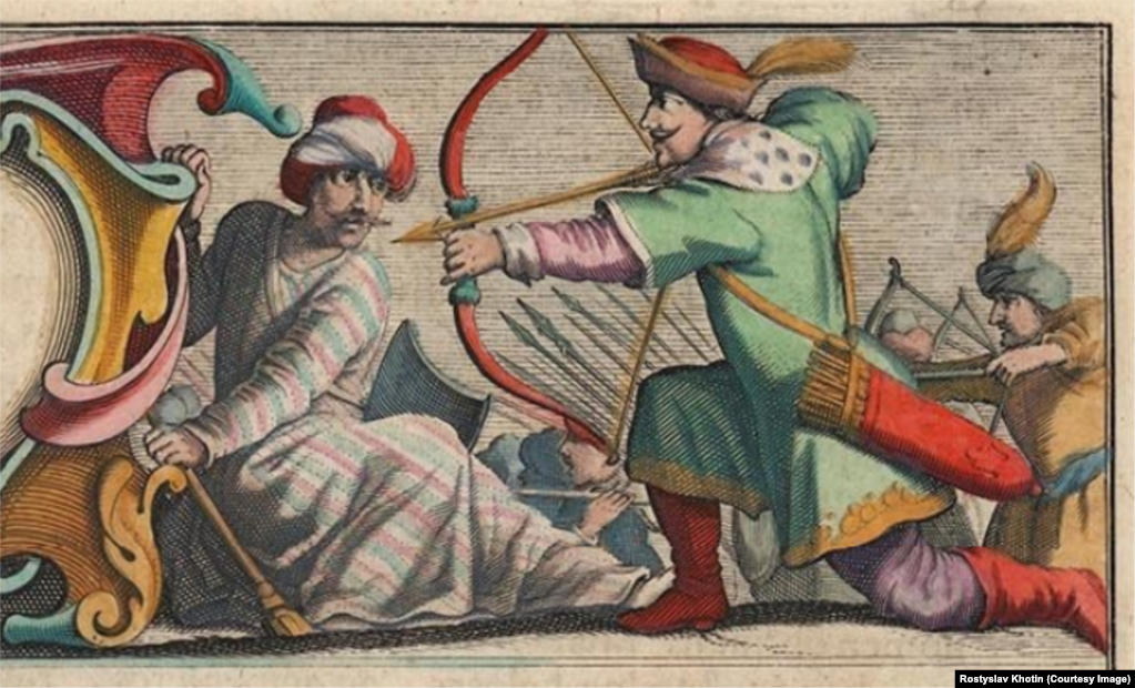
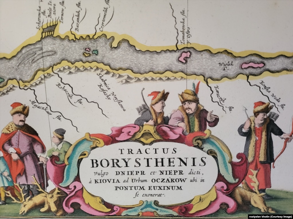
On one of the cartouches – the map of the Dnipro from Cherkasy to Ochakiv near the Black Sea – a battle is depicted. On the right side of the cartouche is a Ukrainian Cossack with a bow, and possibly a Crimean Tatar holding the map’s inscription. The Cossacks and Tatars were then allies in the war against Poland.
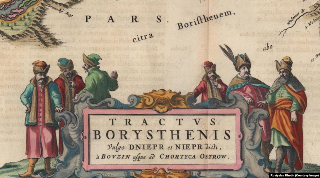
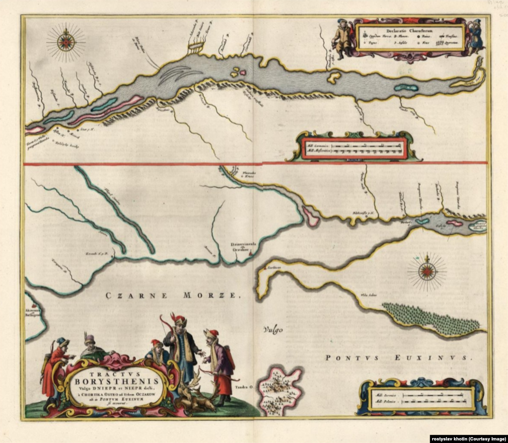
Maps of the Dnipro published by Blaeu in the Netherlands in 1662. Almost all of them are colored. Three maps of parts of the Dnipro show sections of the river from Kyiv to Buzhyn, from Buzhyn to Khortytsia Island, and from Khortytsia to Ochakiv.
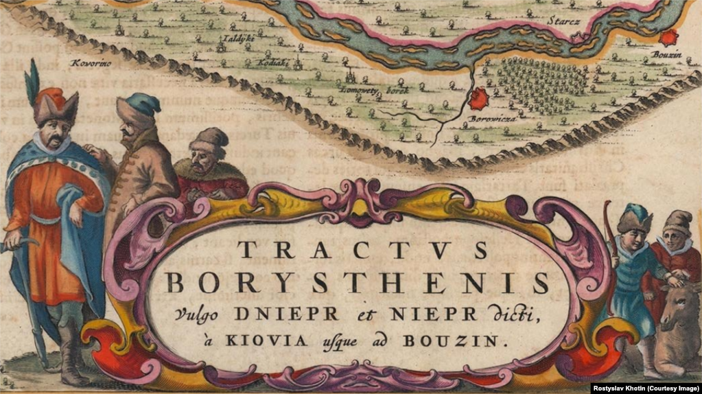
The Cossacks on these cartouches are vividly colored. But did they really wear such colorful, bright clothes?
“If you take an inhabitant of Nuremberg or Paris, they did not dress as brightly in the 17th century as Ukrainians did. Also, it was an Ottoman-Turkish, Ottoman-Arab, Crimean Khanate tradition to dress so brightly. There was an interweaving of cultures, ethnographic features of clothing. Ukrainians always loved beauty. Our nature is also bright. I think we should note the influence of the natural environment on how people dressed – especially the Cossacks,” explains Taras Chukhlib.
And what did Boplan himself write in ‘Description of Ukraine’? “(The Cossacks) are tall, lively, energetic, love to dress well; they especially flaunt this; however, they usually dress very modestly.”
Here is what Ukrainian literature says. In the novel “Hetman Ivan Vyhovsky”, the writer Ivan Nechuy-Levytsky describes the successor of Khmelnytsky: “That day Vyhovsky took a long time to dress and tidy up, put on a brand-new blue zhupan, threw on a red kuntush with gold-stitched cords over it, wore red boots, tilted his hat, and mounted a horse…”
Also, on several cartouches of Dutch maps of the Dnipro, not only prominent Cossacks are depicted, but also lower-rank Sich members engaged in hunting. For example, there are deer they hunted.
“Obviously, hunting occupied a significant part of the Cossacks’ lives. Indeed, the Cossacks were workers who lived, labored, fought, and at the same time engaged in hunting and fishing. This is very well reflected on those maps of the Dnipro,” says Andriy Baitsar.
There is also a map of the Dnipro, published on a single sheet in Amsterdam and Oxford in 1680. In total, there are three versions of this map from different years – it combines the Dnipro from three parts. And there, too, the Cossacks on the cartouche are dressed brightly.
At the end of the 17th century, a small-sized map was published, which is extremely rare due to the minimal print run. It has two variants. The author is the Amsterdam cartographer Johannes Jansson van Waesberg. Published approximately in 1676.
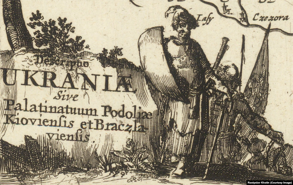
The cartouche depicts a Cossack with a shield in his right hand and a Cossack hatchet in his left hand. A hatchet (topirets) is a general name for axes, often with long handles, which served as both weapons and symbols of status. It might also be a bardiche—a large infantry axe with a crescent-shaped blade on a long shaft (more commonly used by Cossacks as support for rifles).
Mazepa with a Pipe
The print runs of maps varied depending on the editions of the atlases they were included in. The first maps of Ukraine by Beauplan were of small circulation. However, the Dutch maps already had print runs of several hundred or thousands of copies, plus later reissues.
But Ukraine was “promoted” by the German cartographer Johann Baptist Homann, who published his maps in massive editions—essentially setting up the publication of his maps for mass production. Thus, he popularized maps of Ukraine and even marked Ukraine on the map as Terra Cosaccorum—Land of the Cossacks, or Country of the Cossacks.
The map was first published in 1712, and there are four versions of it.
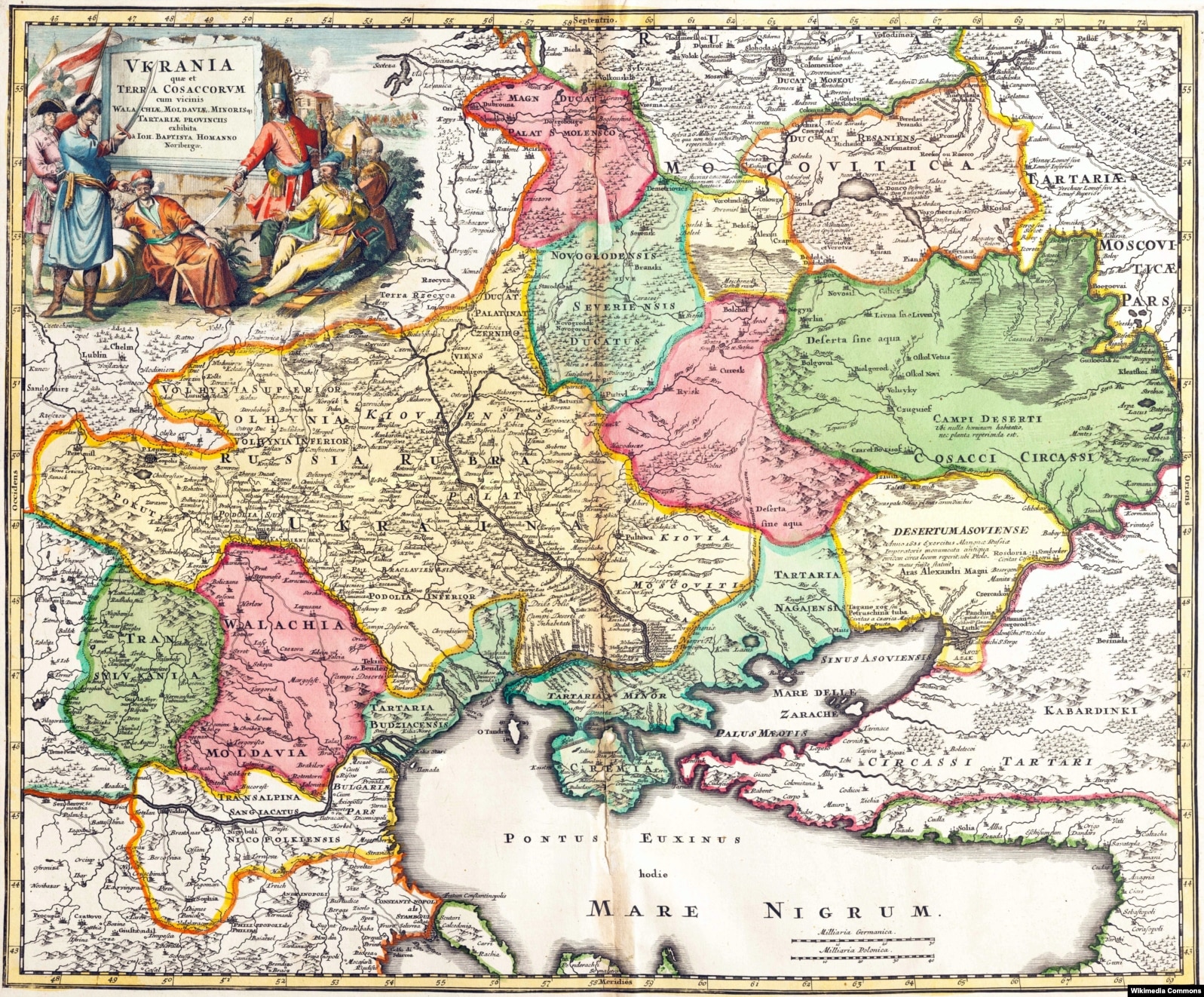
Mostly, cartouches were not colored, but the author of this publication was fortunate to see the original coloring of the cartouche of this map in one of the European libraries.
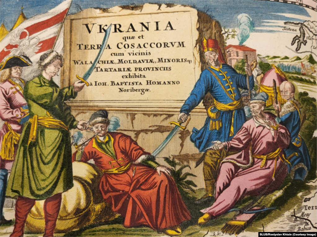
Interestingly, according to experts, in the center sits Hetman Ivan Mazepa in Bender. He went there with the Swedish king Charles XII after the defeat at the Battle of Poltava in June 1709. Also on the cartouche, according to various versions, are Peter I with a flag, possibly Polish king Stanisław Leszczyński, and a janissary, while on the right sit two Cossacks.
“One version is that Mazepa is depicted there, sitting and smoking a pipe,” says Baytsar. Canadian (such as Bohdan Kordan) and American experts on ancient Ukrainian maps are also convinced that Mazepa sits in the center of the cartouche.
Chukhlib adds: “I agree that this depicts Hetman Ivan Mazepa.”
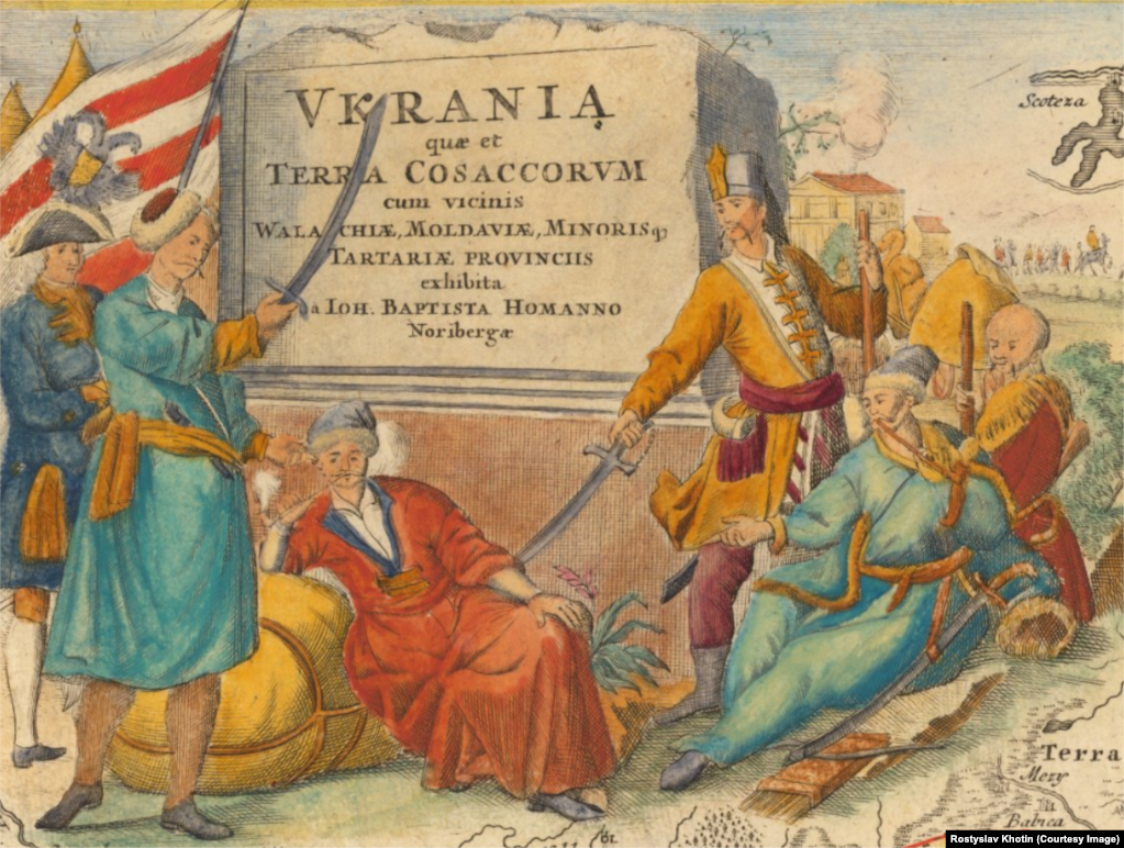
According to one version, on the left side may stand with a raised saber Mazepa’s successor in the hetmanship Pilip Orlyk, author of the Constitution, sometimes called the “Bendery” as it was written in Bendery (now Moldova) and confirmed by Charles XII.
“To the horse!”
A copy of Homann’s map, but smaller in size, is another map by German cartographer and engraver Christoph Weigel (the Elder) — this is a historical copperplate map from the early 18th century, published in 1716 in Nuremberg.
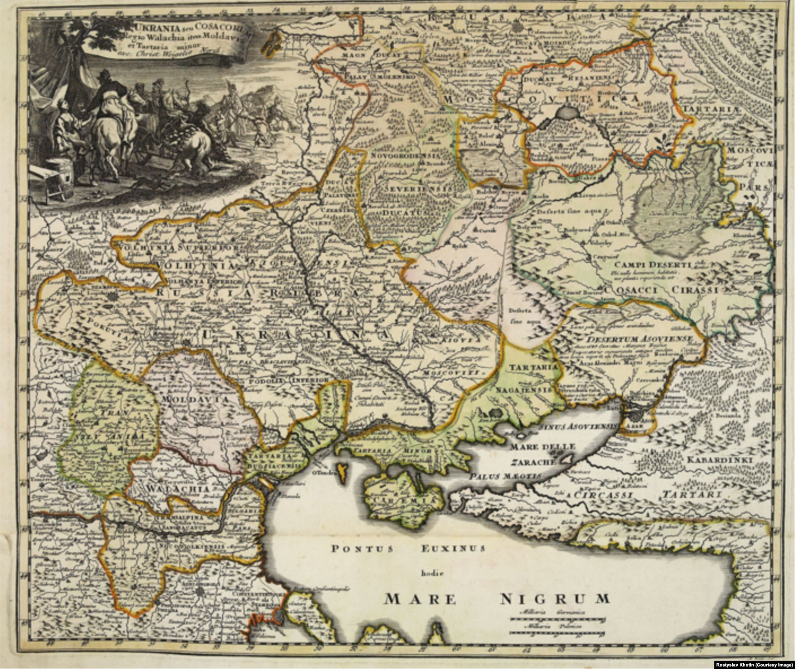
What makes it interesting? Well, firstly, it depicts an entire Cossack camp from which the Cossacks, apparently, are setting out on a campaign.
Some are already on horseback, some on foot, but the Rococo-style cartouche is very dynamic, there is movement—even a dog runs, happily wagging its tail.
Also interesting is that, in the foreground, a Cossack woman is handing a cup to a Cossack on horseback.
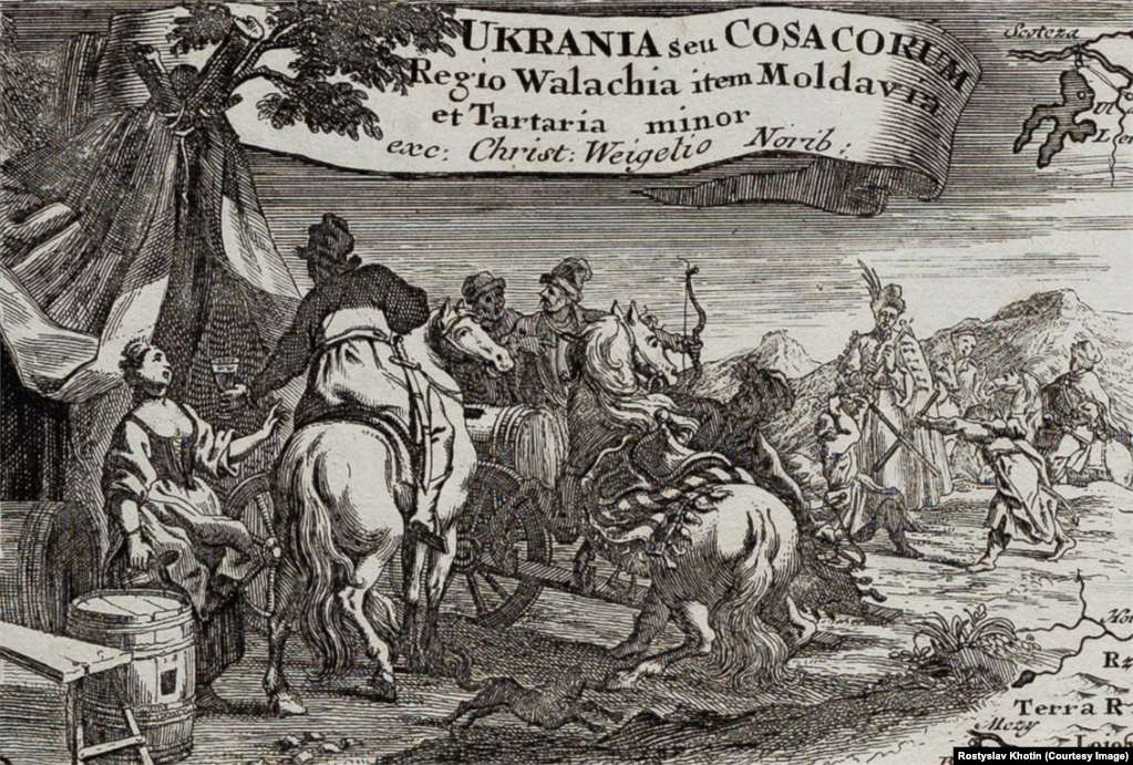
On closer inspection, it is indeed a cup. So, the myth that Cossacks drank only vodka is just a myth. Even in historical literature, there are mentions of beer and wine. Clearly, wine was a more “noble” drink, but the Cossacks drank it too.
Moreover, the cartouche depicts a Cossack woman—again, a woman, which was not typical for maps of other lands or countries at the time, underscoring the high status of women in contemporary Ukrainian society.
Since there were no women in the Sich, it is clear that the 1716 map’s cartouche depicts a Cossack camp in the Hetmanate.
Thus, having emerged at the very end of the 15th century, Cossacks appeared on European maps in the 17th-18th centuries, and even after the destruction of the Zaporozhian Sich by Catherine II in 1775, Ukraine was still marked on maps (including French and English ones) as the “Land of the Cossacks,” though the Cossacks themselves were no longer depicted in the cartouches.
“Military power has always played a significant role in politics and geopolitics. Throughout the centuries, essentially the entire history of humanity is a history of wars. Every country has fought with every country, with its neighbors. And in fact, the Cossacks secured the right for Ukraine and Ukrainians to independence in the mid-17th century,” says historian Taras Chukhlib in an interview. “And we were essentially an independent state at that time. Our statehood was reflected on maps. Ukraine was the country of the Cossacks, and this was depicted by French, German, Dutch, and other European cartographers.”
Source
Copyright © 2021 RFE/RL, Inc. Reprinted with permission from Radio Free Europe/Radio Liberty
